Gaps in Airline Data
Mind the gaps. Whenever I use a public website that provides airline information, I'm impressed with how much they know about flights that are in progress all around the world. However, there have been a number of times when I've started drilling down into the data only to find that the samples I want aren't there. Given that (I believe) a lot of the data actually comes from volunteers that monitor their own local regions with something like dump1090, it should be expected that there are gaps in coverage. That got me thinking: could I look at a day's worth of airline track data and estimate where there isn't coverage?
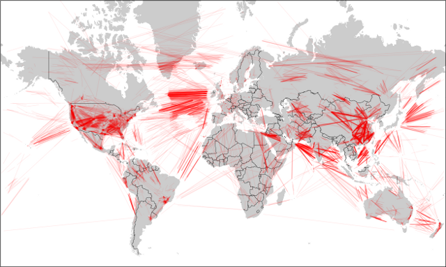
Earlier this week (while flying to Albuquerque!) I wrote a script to search for gaps in a collection of airline tracks. All this script does is walk through a track and inspect the amount of time between two sample data points. If the time for the segment is greater than a certain threshold, I estimate that the plane wasn't in a place where anyone could hear it and then plot the segment in red. Click on the pictures to get a closer view.

Again, missing data segments are in red (segments with data are not plotted, since they overwhelm the plots). As expected, a lot of gaps appear over the oceans, where nobody is listening. As FlightRadar24 has pointed out, coverage in different countries depends on the country's ADS-B policies and ground stations.
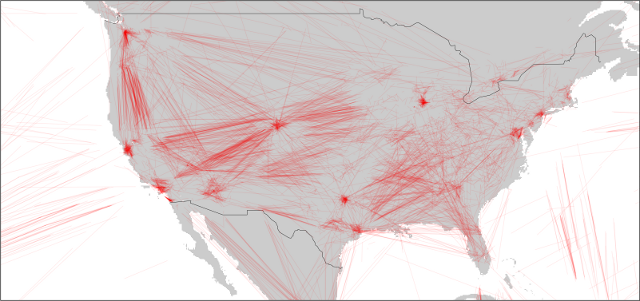
USA
I was a little surprised to see that the US has some dead space in the middle and south east. That might not be surprising as the FAA doesn't make the data available for free (afaik), and there are large unpopulated areas in the country.

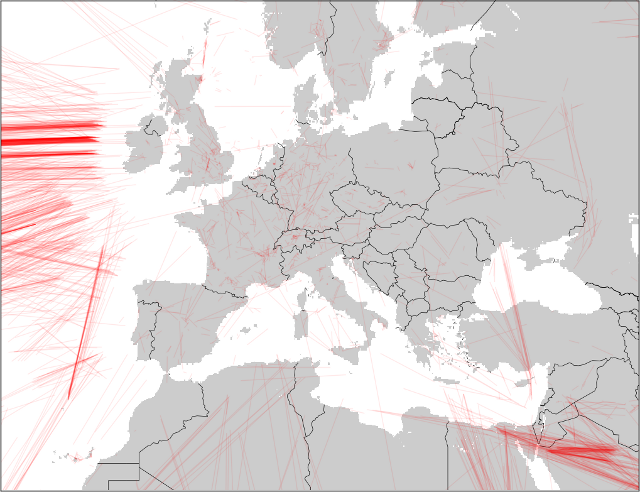
Europe
Europe seems to be well covered. I'm not sure if that's because people do a lot more tracking there, or if governments do the right thing and make the data available.

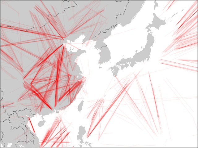
Western Pacific Rim
The Western Pacific Rim is interesting. Japan looks like it has excellent coverage. China must have coverage in the cities or on the coast, as there are a lot of flights with missing data on the interrior.

I'd been hoping there'd be something more interesting to look at around Korea. I've read that North Korea jams GPS from time to time and was hoping that I'd see a lot of gaps there. There weren't any stories of jamming for 2014 (afaik). Plus, I don't think there are many planes flying over NK to begin with.
Code
The gap_plotter.py plotter I threw together for this and a tiny sample dataset can be found here:
This code just overlays line plots, so it's slow and breaks if you throw more than a day's worth of data at it. Some day I'd like to go back and build a propper analysis tool that grids and counts things.